Colorado Trail: Segment 1
Colorado Trail: Segment 1
4/20/2025
Waterton Canyon Trailhead - South Platte River Trailhead
Miles hiked: 17.1 mi
Elevation gained: 2,830 ft (5,512 - 6,541 - 7,516 - 6,103)
Animals seen: ducks, geese, weird black squirrel with ear tufts, almost ran over a turkey car shuttling, definitely no bighorn sheep

Elevation map created on AllTrails
After driving past some houses straight outta Deliverance and a creepy historic hotel, I met my coworker Amanda at South Platte River trailhead for some good ol’ car shuttling. My fool brain decided once we settled here in Colorado that I should conquer the Colorado Trail. Jake took one look at the guidebook and wished me good luck. Now I am not opposed to hiking solo, but apparently Amanda is just as crazy as I am so we are. Now, we aren’t stupid, per say. We had no ambition to spend six weeks thru hiking this monster of a trail, but we did plan on section hiking it. A completion certificate may or may not have played a role in the desire to beat this thing. What can I say, I’m easily convinced.

Anywho, we met at the start of Segment 2, with the plan to leave one car there and drive to the start of Segment 1. She jumped in my car and off we were to the starting trailhead, almost nailing a turkey as we turned the corner, oops.
Arriving at Waterton Canyon trailhead, we grab our day packs and make our way to the pit toilets. Being a reluctant morning person (read: not-at-all morning person) I stupidly got in my car this morning sans brek or coffee. I know! Stupid. So I made an emergency stop en route to meeting Amanda for gas station coffee and breakfast burrito. I sent up all my morning offerings to hope that the burrito wouldn’t turn on me on trail.
As prepared as two people with minimal prep hikes going into a 15+ mile day can be, we begin our 567 mile journey.
Token trailhead pic
Where is a faithful trail doggo you ask? Well, Waterton Canyon is famous for its herd of bighorn sheep. Apparently this particular herd of sheep is rather sensitive to dogs, so they aren’t allowed. Super loud dayhikers, runners, bikers, and pack animals are fine, but not dogs. Also, the herd apparently is unbothered by dogs outside the boundaries of this specific canyon. So long story, not-so-short Leinie was not allowed on this portion of trail, but on a positive, he is allowed on the rest of the CO Trail.
With signs everywhere talking about this famous herd of bighorn sheep, we kept our eyes peeled as we set off. The temperature was hovering mid-30’s so we set a brisk pace to keep ourselves warm.
Waterton Canyon spans the first seven-ish miles of the CO trail. It is a hard-packed dirt road rather than a trail and it is very, very flat. Coupled with it being smack dab in civilization makes it a very, very busy trail. Hikers, walkers, runners, bikers. Know what we didn’t see? Bighorn sheep.

Seven miles of this…and no sheep
Just as our legs started to tire (up until this point my whole two training hikes were no longer than 7 miles), the real trail started.
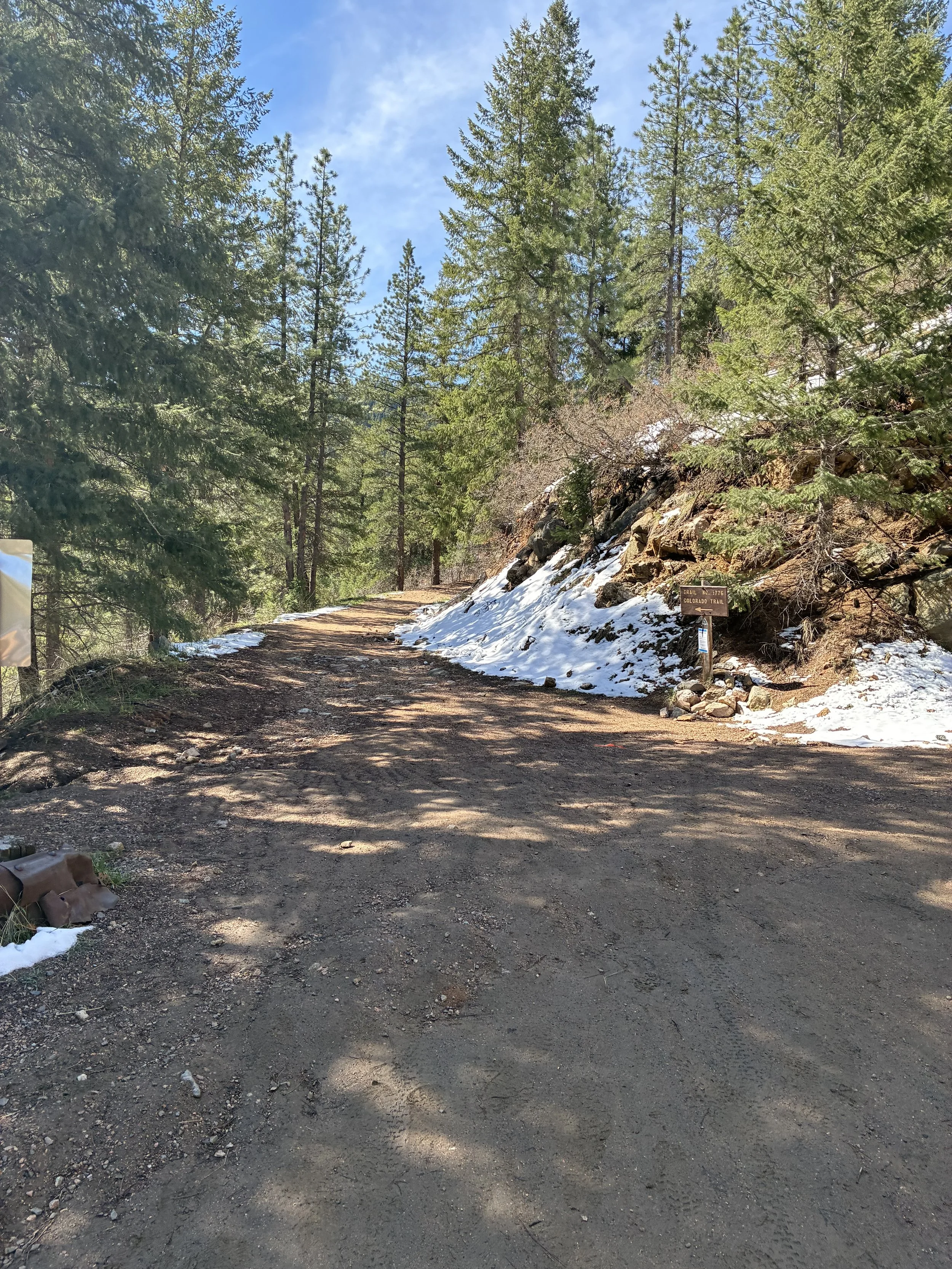
Real trail, for real hikers
We turned onto the single track and immediately started the first giant up of the segment. I quickly shed some layers and busted out the hiking poles. Figuring I should fuel up a bit, I attempted to eat a fig bar only to discover I couldn’t eat and breathe and walk simultaneously. That’s a new one for me. I’m blaming the altitude…
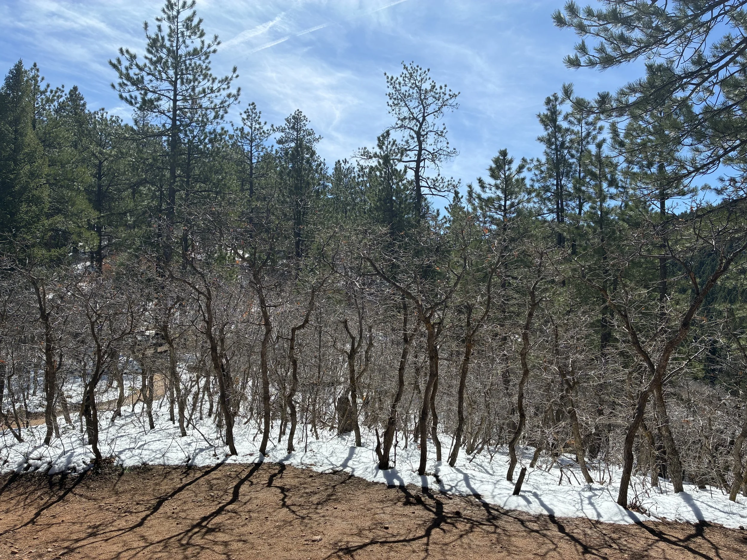
There was a small amount of snow to navigate but we were keeping a good pace. Just as a break was needed, we hit the peak of the first climb and found a glorious resting bench dubbed “Lenny’s Rest”. Well Lenny, rest, we did. Good man, Lenny.
View from Lenny’s Rest
Up next was the big down. Not overly steep, but enough to warrant some careful steps to prevent a slip onto one’s behind. And more down, followed by more down. A bit concerning because the second climb of the segment would bring us to the high point so all the elevation we were losing had to be gained back and then some.
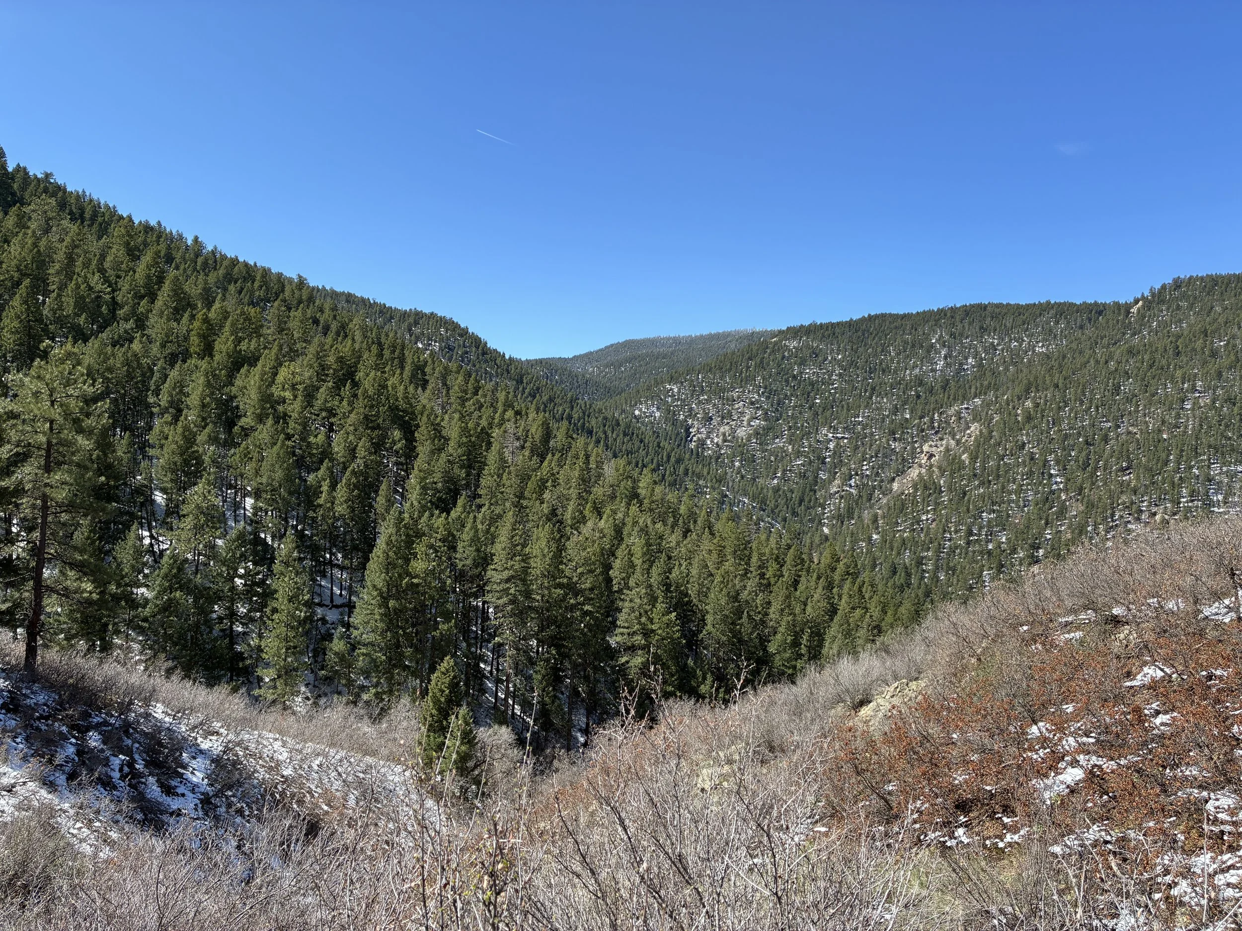
View while we trek downhill
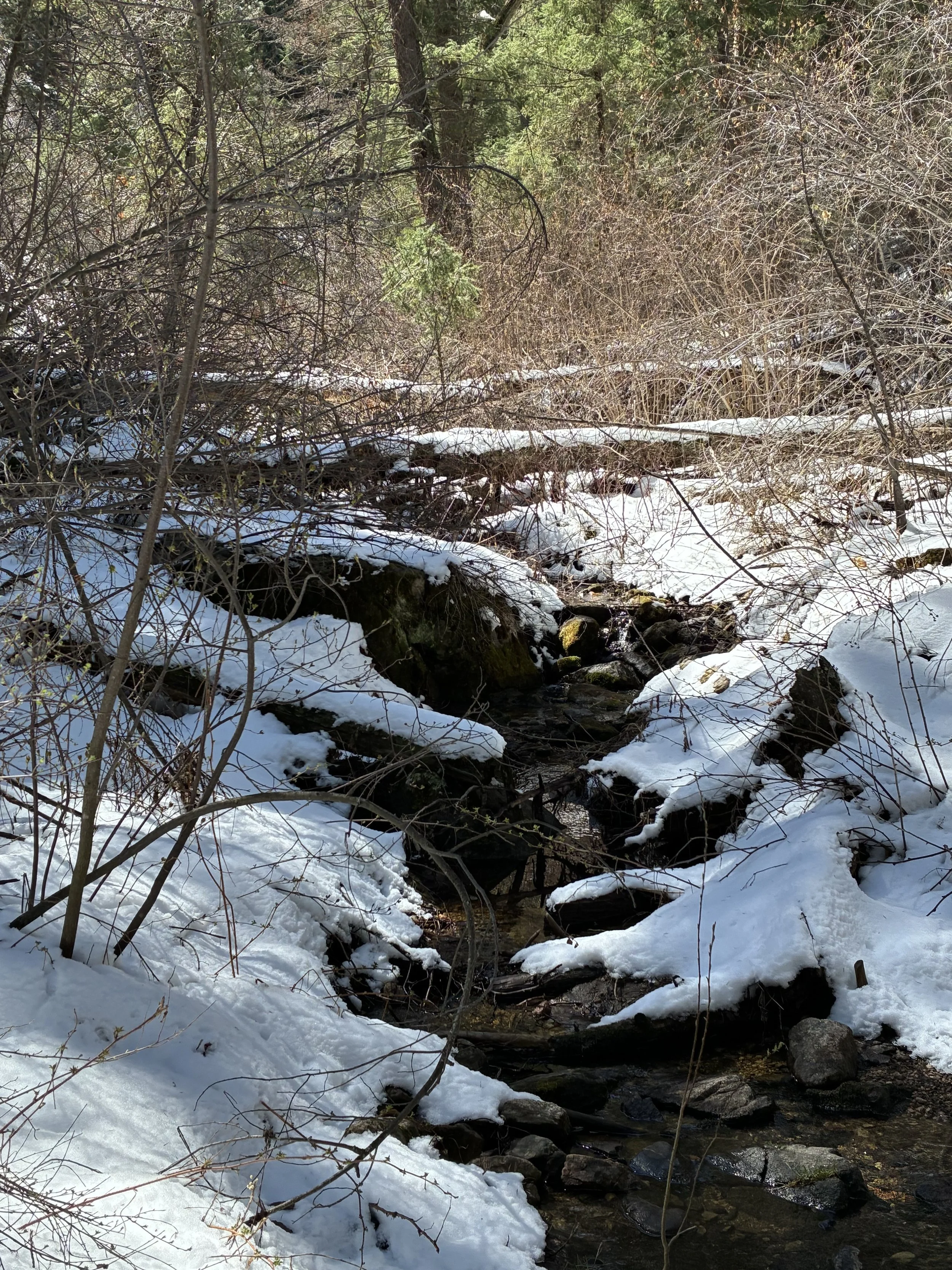
Bear Creek
Finally, we reached the bottom and crossed Bear Creek a few times before an overly punchy start to the final climb of the day. This was a slog, and a rather persistent one at that. Our goal had been to have a lunch break at the high point. Spoiler: we didn’t make it. We found a log in a small clearing and inhaled some food and chugged electrolyte water.
Getting back up to continue was tough, physically and mentally. But our choice was either to continue on for the last five-ish miles or redo the last ten. We chose forward. It was hard. I was dragging, but we just needed to reach the peak and we would end with a short downhill cruise to the car.
Now Amanda and I were both using the same trail app. Mine wasn’t showing the gps map but seemed to be tracking our miles and elevation decently. Meanwhile, Amanda’s map was working but her miles were severely lagged behind what my app was showing. It led to not a little confusion of our exact point on the trail. At one point, we thought we had passed the high point, but the trail suspiciously continued to climb. When we broke through to an amazing view point, we determined this was the high point.
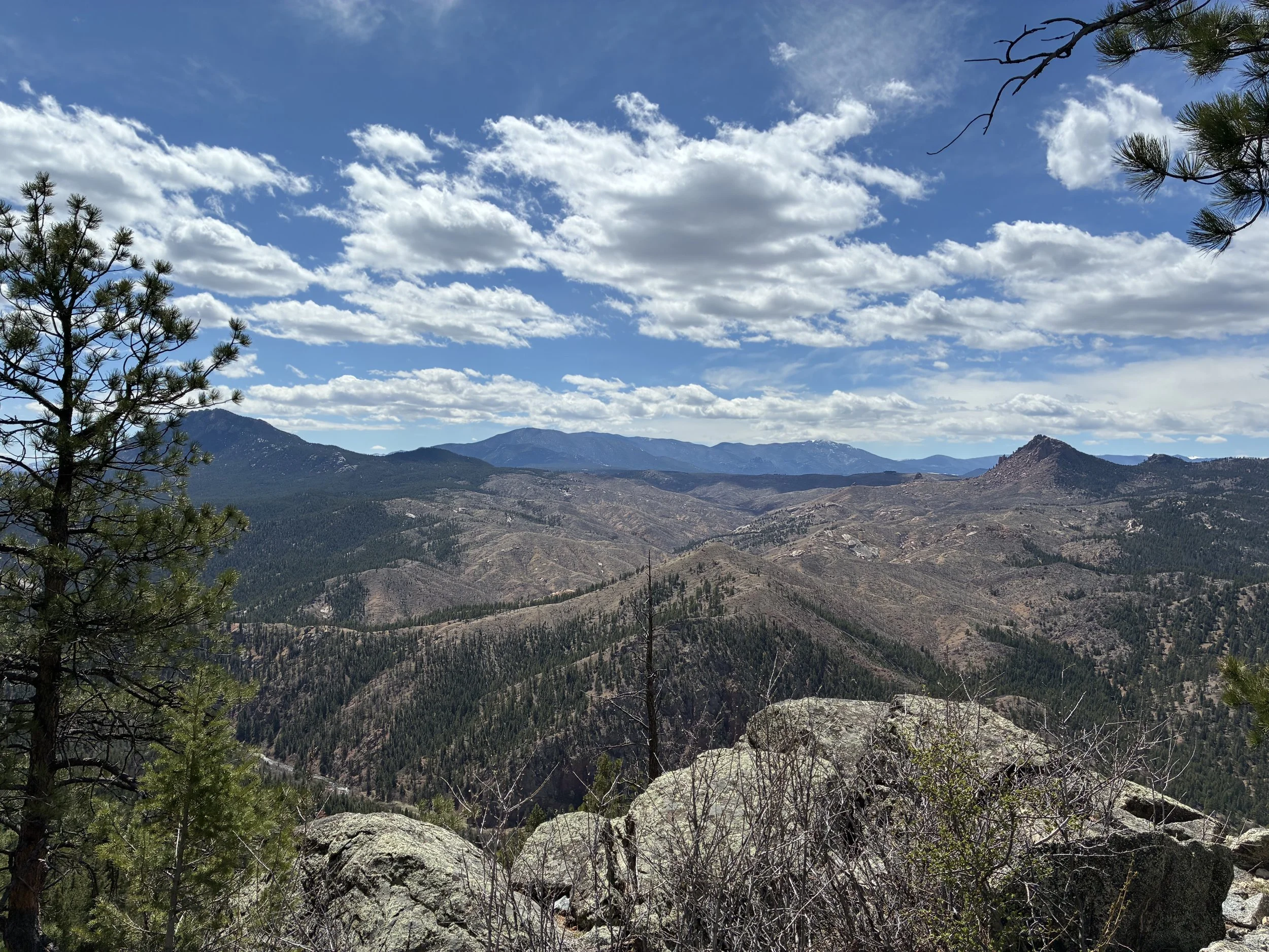
High point of Segment 1
According to my mileage, we had a little over a mile to the car so with throbbing legs and feet we started the trek down. Amanda started pulling away, the pit toilet at the trailhead beckoning while I continued to hobble along the longest switchback of my life. And apparently the longest mile of my life. At one point I thought I must have somehow gotten off trail even though there weren’t any other trails in the area to cross with because I was decidedly going in the opposite direction of the cars.
When I finally stumbled down to the trailhead parking lot, I almost cried from relief. I collapsed into the passenger seat of Amanda’s car and popped some ibuprofen and chugged more electrolyte water. My trail app clocked us just over 17 miles, what?! The trail app reported it was 15.5 prior to hiking, not that I was physically or mentally prepared for that many miles let alone bonus miles.

South Platte River TH
When I was dropped off at my car back at the starting trailhead, I struggled to hobble my way to the driver’s door and get in. To my credit, I did not actually require Jake’s assistance getting out of the car, thank you very much.
See all Colorado Trail posts


We are back at it, following along the epitome of Colorado hiking on Segment 3 of the Colorado Trail with our fearless trail doggo leading the way.